Showing posts with label yellowstone 2009. Show all posts

Wednesday, December 30, 2009

Amphitheater Lake Trail

I finished my Yellowstone trip and my 2009 travels with a fantastic hike in Grand Teton National Park, north of Jackson, Wyoming. Purple Mountain and Mount Washburn Trails were warm-ups for this eleven-mile climb up the foothills of the Teton Range to a splendid alpine lake right near the treeline.

Notwithstanding a late arrival at my hotel the previous night, I started early in the morning, picking-up breakfast and some sports drinks while driving the Lupine Meadows trailhead. I intended to drive straight there, but couldn't resist stopping for several views of the mountains especially one at Cottonwood Creek Turnout with the golden aspens in the foreground, which I actually backtracked to snap a picture.

Despite the stops, I reached the trailhead in time to start the hike around 9:00 AM. After only a few hundred flat yards, the trail began it's relentless 3,000 ft climb up the mountainside. To the right, I could catch only a few glimpses of the imposing mountains through breaks in the forest. After about a half mile running south—parallel to the face of the mountain—the trail bent right and started running along a 'toe' of the foothills, a ridge with dropoffs on either side. I tried to catch a peek of the mountains ahead, but the trees and hills limited commanded the view.

Full Screen Version


Two miles in to the hike, I reached the first trail junction. Beyond this point, the serious climbing started. Several switchbacks angled up the steep face of the hill alternating between open and forested hillside. After mile-plus of this scenery, I reached a second trail junction and sat down for a couple minutes to rest. Again, beyond this junction, the landscape changed. The climb remained steep, but white, moss-covered boulders gradually took over. The air also smelled of a pleasant pine forest as the lodgepoles gave way to more gnarly conifers.

I took more frequent breaks as I trudged up the last few miles of trail. At 11:49 AM, I reached Surprise Lake (elev. 9,540 ft.) just a short distance downhill from the end of the trail at Amphitheater Lake. Leaving the trail, I walked along the shore of the lake to find its outlet. Here, the views of Garnet Canyon and Jackson Hole encouraged me to stop, rest and snack for a spell, which I did even though I couldn't find a comfortable boulder—out of the hundreds piled about—to sit.

At 12:15 PM, I left Surprise Lake and completed the last ten minutes of the trail to Amphitheater Lake (elev. 9,698). True to its name, the lake resides in a natural amphitheater with Disappointment Peak rising in the back, and Jackson Hole opening out in front. Very scenic to be sure, but I wanted to see the majestic Teton Peaks from up close, or at least as close as a bumbler like me is apt to get so I continued passed the end of the official trail.

My extra efforts were amply rewarded. A rough trail disappeared halfway up a ridge to the north of the lake. Scrambling of the rocky terrain, I reached a precipice overlooking Glacier Gulch. I had gone as far as I could prudently go, but straight ahead was Mount Owen. I mistook this the second tallest peak for Grand Teton, the tallest mountain the range—only after returning and sorting through pictures did a realize the error. No matter, the view was truly grand and a satisfying conclusion to the hike.

Well, I did still have to hike down the mountain, but that was a breeze compared to the ascent. On the climb, I had been so preoccupied the route and mountains ahead that I didn't consider the vast valley stretching out behind me. On the down hike, most evident in the breaks in the forest halfway down, Jackson Hole filled my field of vision. Making good time, I reached the car at 3:20 PM and promptly began the drive back to Salt Lake City.

Trip Statistics
Length: 11.4 miles
Time: 6 hours 18 minutes
Elev. Change: 3,327 ft.
Max Elev.: 10,048 ft.


This is a very, very rough approximation of the route Amphitheater Lake Trail takes up the face of the Grand Tetons. The arrow points to the approximate location of Amphitheater Lake and partially covers Grand Teton. Mount Owen is the peak immediately

Elevation Profile

Monday, December 28, 2009

Detour

Risk assessment is a big part of life. Sometimes, we assess the risks, determine the logical course, and elect to act in opposition to that acuity. This story is one such episode. I knew the risks, took a chance, and it it didn't pan out. I submit it for your potential amusement.

On this, my second, trip to Yellowstone, I had two 'must-see' places to visit, Mount Washburn and Artist Paint Pots, both on the north side of the park. Having entered into the southern half of the park, two factors conspired to complicate my efforts: road construction and a forest fire. A loop road connects the two halves of the park. Road construction closed the western leg of this loop for the season; a forest fire intermittently closed the eastern leg.

I managed to depart early in the morning on my second day in the park, hike Mount Washburn and return to the critical junction to find the road still open. There, I considered taking satisfaction in a partial success and returning to the southern part of the park. This option would bypass Artist Paint Pots, but it would also leave me closer to Jackson, Wyoming, and my bunkhouse for the night. I opted for against it and spent the afternoon exploring Artist Paint Pots and nearby Norris Geyser Basin.

Hours later upon leaving Norris Geyser Basin, I spotted a ranger set-up in the road ahead, and had a pretty good idea the news she would deliver: the road to Jackson was closed. So instead of a 127 mile, three-hour drive, I had a 324 mile seven-and-a-half hour drive, an extra 200 miles and four-and-a-half hours, ahead of me.

Full Screen Version


Two months later, I recognize my losses were minor: a few hours (most of it in the dark when you can't do much else but sleep), added driving fatigue, and some gas money. In return, I achieved my two 'must sees' for the trip, spent a wonderful few hours in Norris Geyser Basin, drove through Montana's picturesque Paradise Valley in the waning hours of the day, and stopped along the road to hear the some nighttime geyser eruptions and elk bugle calls. All that considered, maybe it wasn't such a bad risk to take. Not that I wouldn't decide differently if I had it to do over again.

Sunday, November 22, 2009

Mount Washburn

I started my second day in Yellowstone with a morning hike to the top of Mount Washburn. I had wanted to tackle this hike on my first trip to the park, but lacked the time and dare I say the gumption for such a long endeavor hike. Stepping out of my car in to the cold air, I decided to add an extra layer. As I reviewed a map at the trailhead a couple started on the path ahead of me, but shortly thereafter, they turned around, presumably to get something from their car, and I had the trail to myself. In fact, I didn't see another person until I was at least a third the way to the top.

Full Screen Version


The trail started on the backside of an unmarked peak to the southwest of Mount Washburn. Less than a mile from the start, the trail swung around 180 degrees and I caught my first glimpse of the fire lookout on the top of the mountain. It wasn't so much the distance or the height that struck me, but that I appeared to be on the wrong side of a valley from my desitination. Unsure how the trail obtained the summit, I forged ahead knowing I find out soon enough.

Originally built as a road to the summit, the trail wide trail consisted mainly of crumbled asphalt or course gravel. Though it was a constant climb, much of the ascent came in the middle third in a series of long switchback. I got my first real expansive view while found the corner on after the last switchback. Not long thereafter, I surpassed the treeline. I took one short break on the in the last third of the hike, but still managed to make it to the top before noon, roughly an hour and forty minutes after I started.

I found the building at the summit to be far more substantial that expected. A large room with windows on three sides was attached to the south end of a three story fire lookout. An open patio covering the observation room provided the best views of the park, but cold winds kept my time there short. The ranger who resided in the lookout for the summer was packing out for the winter, which seemed a little bizarre with a large fire blazing to the south. Ominously, he grimaced when I said I had plans to stay in Jackson on the far side of said fire, but I wouldn't heed his advice to head directly south after my hike.

Tough I spent forty-five minutes at the summit, it seemed like a lot less time than that. After a few leg stretches, I started back down the trail arriving at my car a little more than an hour latter.


My first glimpse of the summit of Mount Washburn came after about 15 minutes of hiking. In another hour and half, I'd be standing in the observatory at the end on the trail.


Dunraven Peak is about 9,900 ft, roughly 1,300 ft shorter than Mount Washburn. In Dunraven pass between these two mountains, I found the trailhead at elevation 8,900 ft.


A panorama I pieced together from pictures taken at the summit.


The Hayden Valley is the first place I ever saw buffalo. In spite of the Arnica Fire, could still see a bit of the Grand Tetons seventy miles to the south.


Me standing at the summit sign.


This lonely trail heads eight miles to the Grand Canyon of the Yellowstone.

Trip Statistics
Length: 7.3 miles
Time: 3 hours 33 minutes
Elevation Change: 1,400 feet
Max. Elevation: 10,243 feet

Elevation Profile


Saturday, November 14, 2009

Purple Mountain Trail

At noon on Saturday, I set-off on the first serious dayhike of the vacation. Short jaunts characterize my few excursions on Friday. Finally inside Yellowstone National Park, I parked at the Purple Mountain Trailhead not far from Madison Junction. The three mile trail climbed steadily up to Purple Mountain Peak. Almost without interruption, lodgepole pines flanked the side of the trail. The first half of the hike cut up the foot of the mountain in a straight line—or a least as straight as you'd expect to find in nature-with the sun almost right behind me. The trail steepened as is swung around 180 degrees out a sizable ravine and then leveled of for a bit before climbing the last 1.5 miles to the peak along a series a switchback with fantastic southern views. A lonely hike, I encountered my first fellow-hikers in the last 200 yards of the trail and no one else was present when I reached the overlook at the end of the trail.

Full Screen Version


I first noticed smoke from a forest fire off to the southeast. At first, I thought it was a pretty neat sight, then I considered that my planned itinerary for the next day required driving on one open road in that direction. Directly south, I recognized Fountain Flats, the northern extremity of the highest concentration of geysers in the park and my next destination following the hike. Even though the views were great, I didn't tarry long before starting the return hike. I went fast enough to catch the hikers I met just before reaching the summit. Back at the car I had a pretty long chat with one of them while reapplying sunscreen.


Purple Mountain from Terrace Spring. Lighting changes during the day and season so the explorers probably saw purple mountain when the named it.


Arnica Fire as seen from Purple Mountain. I lightning strike started this fire a few days before my visit.

Firehole Valley. The loop road climbs along side the Firehole River. The main geyser area is just over the horizon.

The true summit of Purple Mountain. Yes I did climb it.

On the descent. The forest fire is visible just to the right of the trees in the center of the picture.

Gibbon Meadows. The mineral rich water that flows from Terrace Spring (where I took the top photo and visible in the lower left) and other sources prevents vegetation from growing in the broad swath on the banks of the Gibbon River.

Trip Statistics
Length: 6.5 miles
Time: 2 hours 57 minutes
Elevation Change: 1,500 feet
Max. Elevation: 8,433 feet


Thursday, November 12, 2009

Logan Canyon

From Promontory, I could have driven straight to Yellowstone in about five hours and been their before dark, but any one who knows me knows that the would have been Plan B. Plan A crossed the Bear River Mountains east of Logan, Utah, turned north at Bear Lake toward Soda Springs, Idaho, returned to I-15 south of Pocatello, and stay the night in Idaho Falls still 100 miles and two hours from the park.

Full Screen Version


This circuitous route allowed to drive the Logan Canyon scenic byway, easily the highlight of the trip. In prepare for the trip, I had even considered the possibility of seeing fall colors, but the trees at the latitude and elevation were ablaze. I stopped at a few sites along the way, most notably at the end of a side ride at Tony Lake. I might have skipped it because of the extra driving time and would have been poorer for not seeing the tranquil mountain lake. I only regret I didn't have time to start on one of the longer hikes that leaves from the area.

Sunday, November 8, 2009

Golden Spike National Historic Site

I didn't so much plan to take a trip to Yellowstone this year, as I bought a cheap plane ticket to Salt Lake City and then asked what I could do with four days in the vicinity. Golden Spike National Historic Site, the place where the Union Pacific and Central Pacific joined their rails on May 10th 1869, was the one site I absolutely wanted to see. The rest of the trip evolved from there.

From Spiral Jetty, I started on the crude dirt road back toward the Golden Spike Visitor Center. But first, I investigated an auto-tour on the west side of the park. I misinterpreted a sign for a different road and thought the auto-tour was not suitable for for sedans. Having already had enough with unimproved road services, I went straight to visitor center. Though I acted on misinformation, it probably worked out for the best as I later drove the shorter east auto-tour route and expect I got a comparable if shorter experience.

Full Screen Version


After watching the twenty-minute movie in the visitor center and making a few purchases at the gift shop, including for $10 Men to Match My Mountains, a Western history book that I started reading and am aleady impressed with, I went out to the actual spot where they held the joining ceremony nearly 150 years ago. The park has arranged the spot to match the famous picture taken at the event. Replica Jupiter and No. 119steam engines face each other just like they did on that historic day.

Leaving the visitor center, I drove east to a trail that uses pieces of the parallel grades for a two-mile circuit to the Big Fill, an engineering feat the Central Pacific built to carry their tracks over a gully in the side of the Promontory Mountains. There, they dumped as much dirt as needed to carry the tracks over the obstacle. But for the missing tracks (abandoned around 1900 and used for scrap metal during WWII), it looks it could still carry a train. The Union Pacific built a rickety trestle to cross the same gully. It didn't last nearly as long.

One noteworthy tidbit I learned on my visit is that both Railroads operated a station at Promontory Summit for about a year after joining rails. Passengers had to transfer between trains at this station to continue their westward or eastward journeys. In early 1870, the moved the junction to Ogden.

Standing at the site of the Golden Spike Ceremony


Jupiter Replica. The locomotive pulled Leland Stanford to Promontory Summit


Central Pacific Grade looking west from Promontory Summit.


Replica Last Tie. Made of Laurel.
Inset: Detail of the Plaque on Last Tie.

Twin Grades a few miles east of Promontory Summit.
The Central Pacific graded the line to the left; Union Pacific to right.


The Big Fill. The Central Pacific's method to cross this valley.
The Union Pacific built a trestle to left. The abutment and rock cut are still visible.

Sunday, November 1, 2009

Spiral Jetty

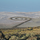
Years ago, I read about Robert Smithson's Spiral Jetty in an article in theWall Street Journal and thought to myself, "that's something I have to go see someday." In due course, I forgot all about it. After I purchased a flight to Salt Lake City for my final trip this year, I considered nearby Golden Spike National Historic Site a must for the itinerary. Fortunately, their website mentions Spiral Jetty as a nearby attraction. As soon as I saw that recommendation, I recalled the article and added it as a stop, the first as it turns out, for this trip.

Full Screen Version


The sculpture, built by Smithson in 1970, lies along the northeastern shore of Great Salt Lake. Golden Spike NHS is itself remote, but Spiral Jetty is sits fifteen miles down a progressively unfriendly dirt road. Once unable to tolerate the unforgiving road and sufficiently close to walk, I parked the car and started climbing the nearest hill, which mercifully was the correct one, Rozel Point, where I got my first view of the artwork.

Hiking along the edge of Rozel point for about a mile, I took pictures of the jetty from various angles. Once I couldn't see it from the ridge any more, I descended the hill to get a closer inspection. The water level was so low that the lake didn't even lap against the edge of the jetty. I walked to the very end and back, about a half a mile it total. At the very end some one had arranged pebbles to spell out "you matter," a nice sentiment.

Before returning to the car, I explored a nearby, functional jetty and walked to the the very edge of the Salt Lake. I tasted the red, brackish water (salinity 27%), but reflexively spat it out without drinking. The salt beach had a slight give in it, and salt crystals chimed, as I walked back to the solid jetty.

For more information, click here to read the Wikipedia article on Spiral Jetty

Elevation Profile


Trip Statistics
Length: 4.8 miles
Time: 2 hours 15 minutes
Elevation Change: 433 feet
Max. Elevation: 4,629 feet


Great Salt Lake from Rozel Point. Spiral Jetty in the foreground.


Spiral Jetty from the shoreline.


Start of Spiral Jetty


Great Salt Lake Shore


Rozel Point.

Monday, October 26, 2009

Yellowstone 2009

In May of 2006, I took, as I consider it, my first serious vacation. By serious, I mean, more or less, that I flew somewhere, rented a car, and stayed away for at least week. The destination was Yellowstone National Park. Since then, I must have visited everything else there is to see, because, when planning to squeeze one trip in this year I found my way back to Yellowstone. Not to put to fine, I put on it, but I do see the return to trodden ground as a milestone for me, someone for whom much of travel's lure is the opportunity to explore new areas. In truth, I spent most of the trip visiting virgin territory outside the park. Even once in Yellowstone, I spent more time climbing new trails, than in previously visited areas.

Full Screen Version


Whereas on my first trip I flew to Denver, this time around I landed in Salt Lake City, which is closer to the park. In fact, it was the the cheap, direct flight to SLC that first lured me to that airport. Only after purchasing the plane ticket did I opt for an itinerary leading to Yellowstone. Once on the plan, I discovered an added bonus. Delta had equipped it with a fancy entertainment system that allowed me to play trivia against other passengers or watch live TV on the small screen built in to the seat in front of me. I did well on the trivia, winning quite a few rounds, but not earning the high score for the day. Sadly, ESPN was one of the few live TV channels that didn't work so I couldn't watch the Thursday night college football game.

I spent the first day and half taking an indirect route to Yellowstone. Along the way, I stopped at a number of sites, including Spiral Jetty, Golden Spike NHS, Logan Canyon Scenic Byway, and the Teton Dam ruins. Once in Yellowstone, I stretched my legs on a six mile hike up and down Purple Mountain, before heading to the geyser basins for the rest of the day. I followed a similar pattern on Sunday, hiking up Mount Washburn in the morning and wandering about Norris Geyser Basin in the afternoon. It culminated on Monday with my most ambitious hike, the 3,000ft climb to Amphitheater Lake in Grand Teton National Park, after which I drove back to Salt Lake City to catch an early Tuesday morning flight back to Philadelphia.

Yellowstone Photo Album

(This photo album contains all the pictures used in the Google Map. You can also see any picture by clicking on a blue pin and following the direct link to the that picture in the album.)

.